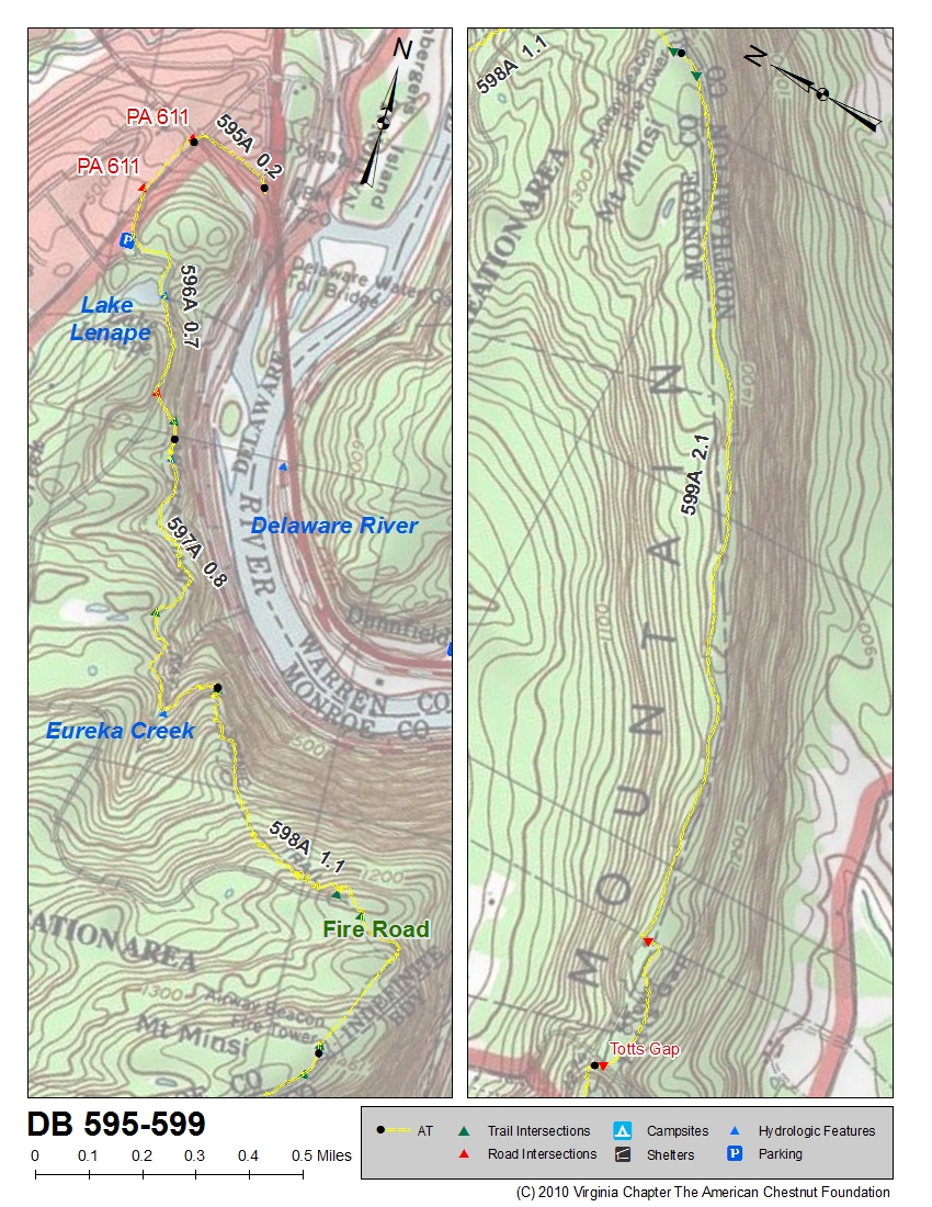
from Mt. Minisi (599) to Antietam Shelter in Old Forge Park (721)
| State | Segment Begins | Segment Ends | Beginning Location of Segment | Map | Chart |
|---|---|---|---|---|---|
| PA | 599 | 599 | Mt. Minisi | Map of 595-599 | Chart of 595-599 |
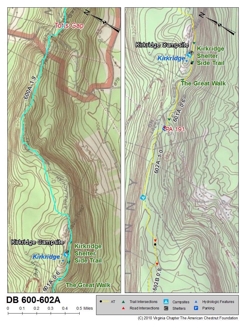
| PA | 600 | 602A | Totts Gap | Map of 600-602A | Chart of 600-602 |
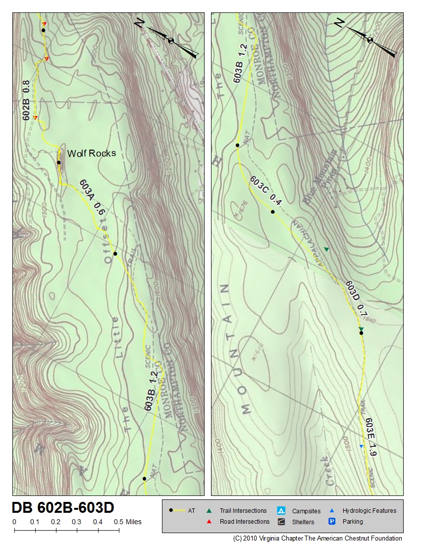
| PA | 602B | 603D | just north of Wolfs Rocks | Map of 602B-603D | Chart of 600-602 (see below also) |
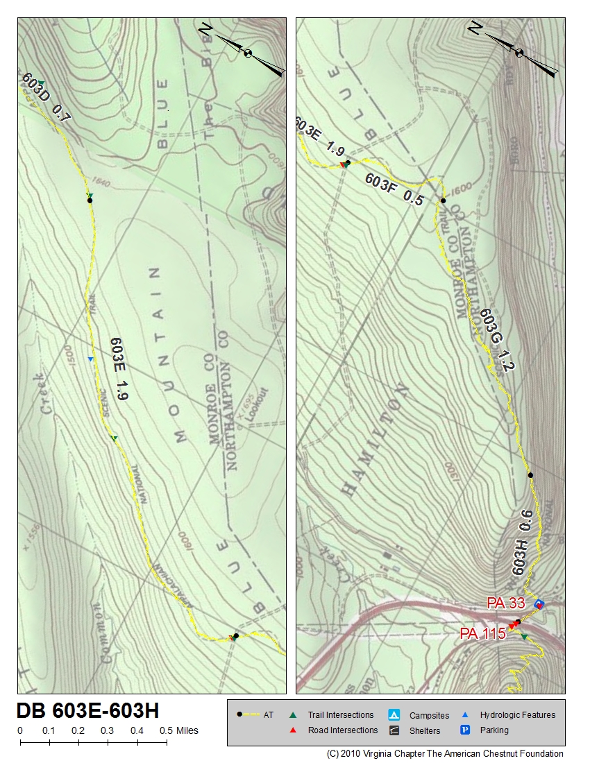
| PA | 603E | 603H | near Monroe and Northampton County lines | Map of 603E-603H | Chart of 603 |
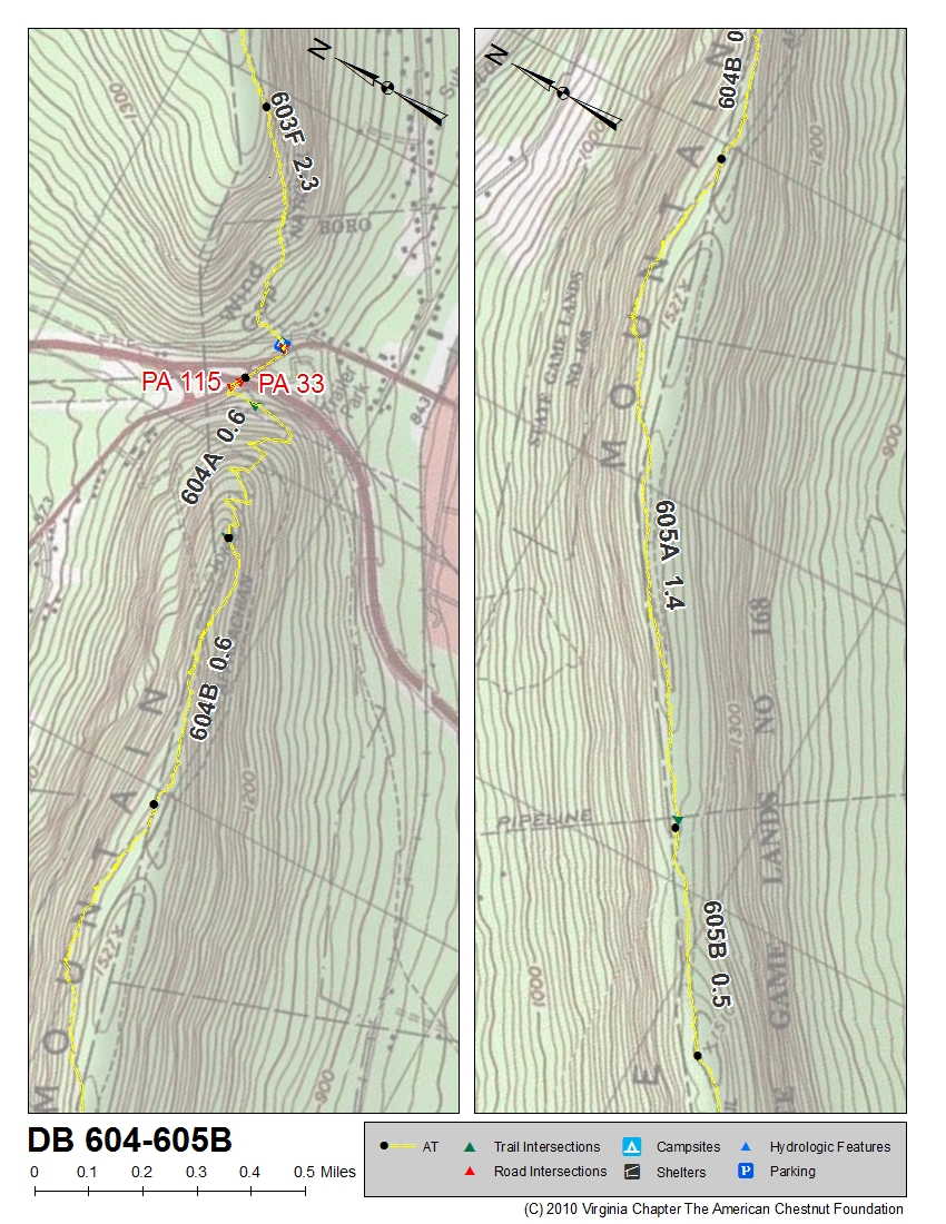
| PA | 604 | 605B | PA 33 | Map of 604-605B | Chart of 604-605 |
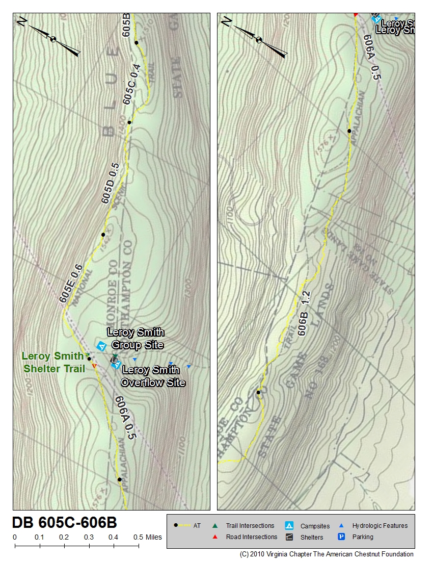
| PA | 605C | 606B | ~1.5 miles north of Leroy Smith Shelter | Map of 605C-606B | Chart of 606-607 |
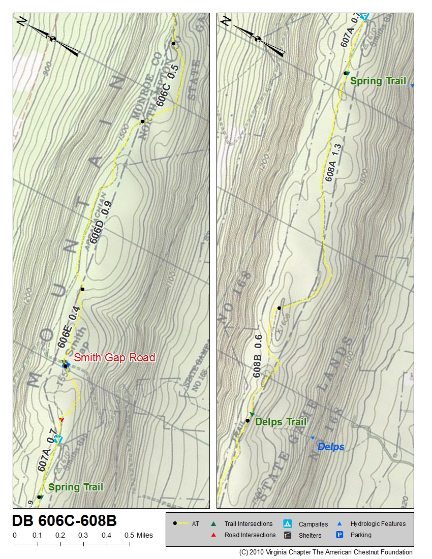
| PA | 606C | 608B | ~2 miles north of Smith Gap Road | Map of 606C-608B | Chart of 606-607 |
| PA | 609 | 609 | Delps Trail | Map of 609 | Chart of 609 |
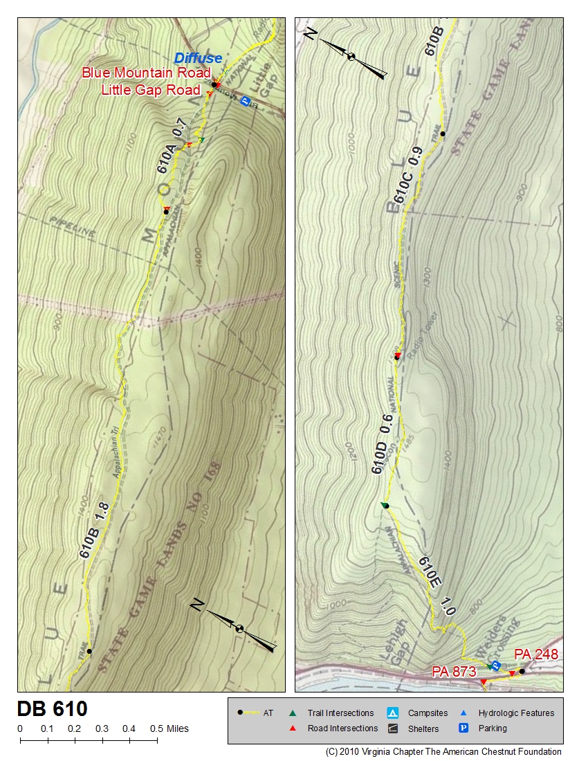
| PA | 610 | 610 | Little Gap | Map of 610 | Chart of 610 |
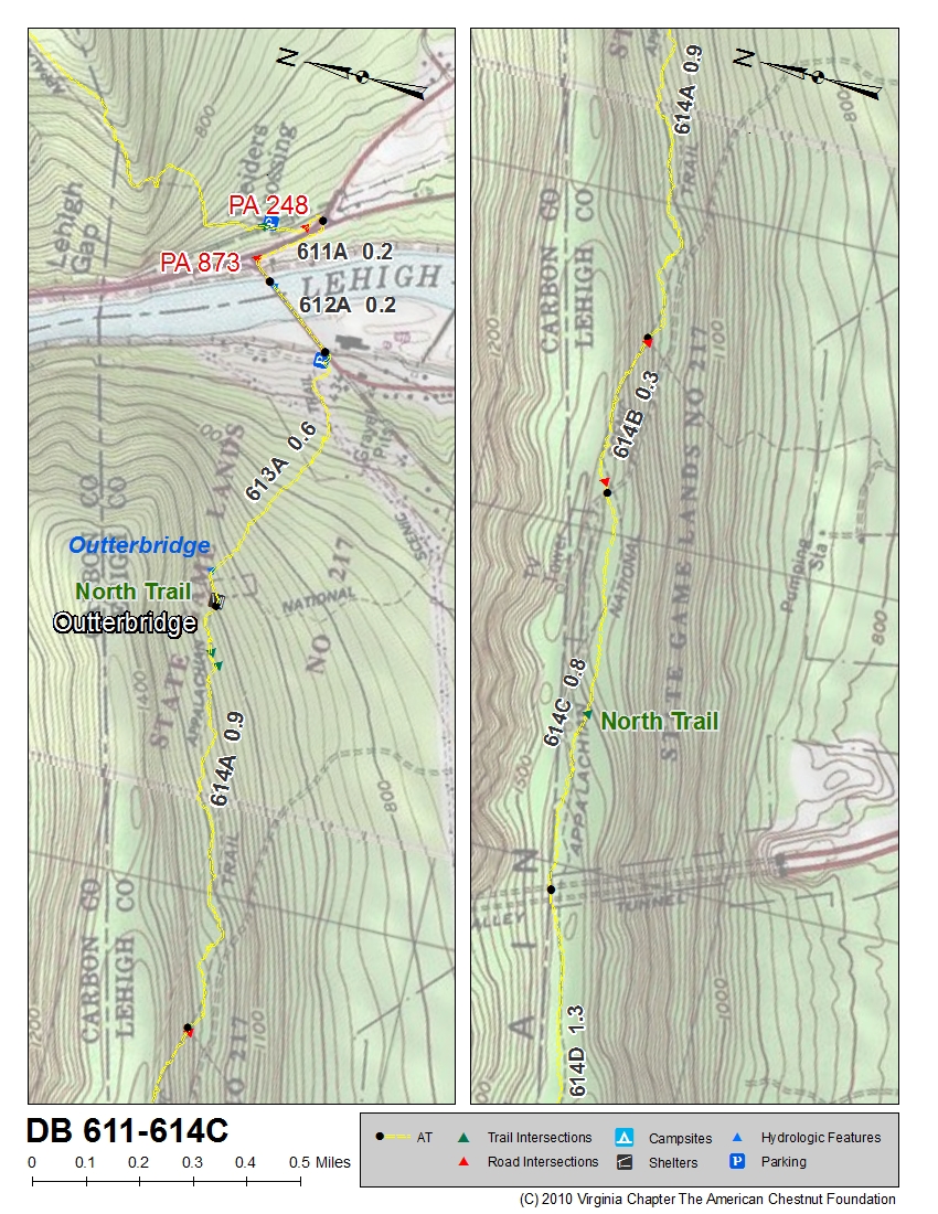
| PA | 611 | 614C | PA 248 | Map of 611-614C | Chart of 611-614C |
| State | Segment Begins | Segment Ends | Beginning Location of Segment | Map | Chart |
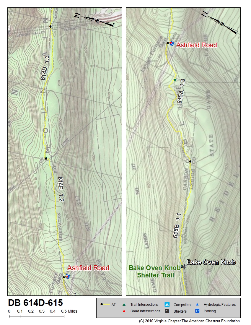
| PA | 614D | 615 | ~2.5 miles north of Ashfield Road, Lehigh Furnace Gap | Map of 614D-615 | Chart of 614D-615 |
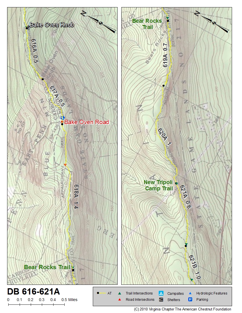
| PA | 616 | 621A | Bake Oven Knob Shelter | Map of 616-621A | Chart of 616-621A |
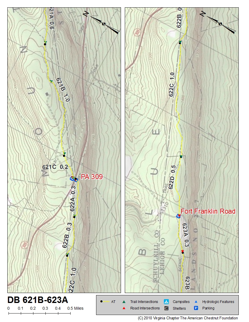
| PA | 621B | 623A | ~1 mile north of PA 309 | Map of 621B-623A | Chart of 621B-623A |
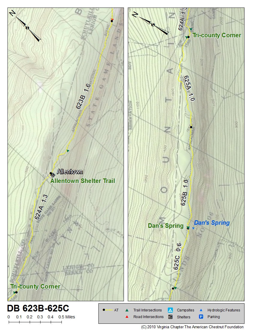
| PA | 623B | 625C | ~1.6 miles north of Allentown Shelter Trail | Map of 623B-625C | Chart of 623B-625C |
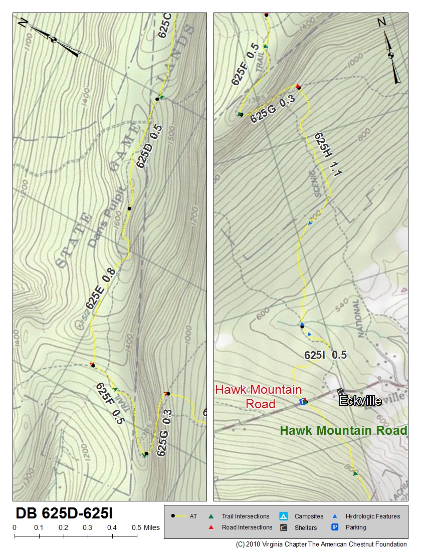
| PA | 625D | 625I | ~0.6 miles south of Dan's Spring | Map of 625D-625I | Chart of 625D-625I |
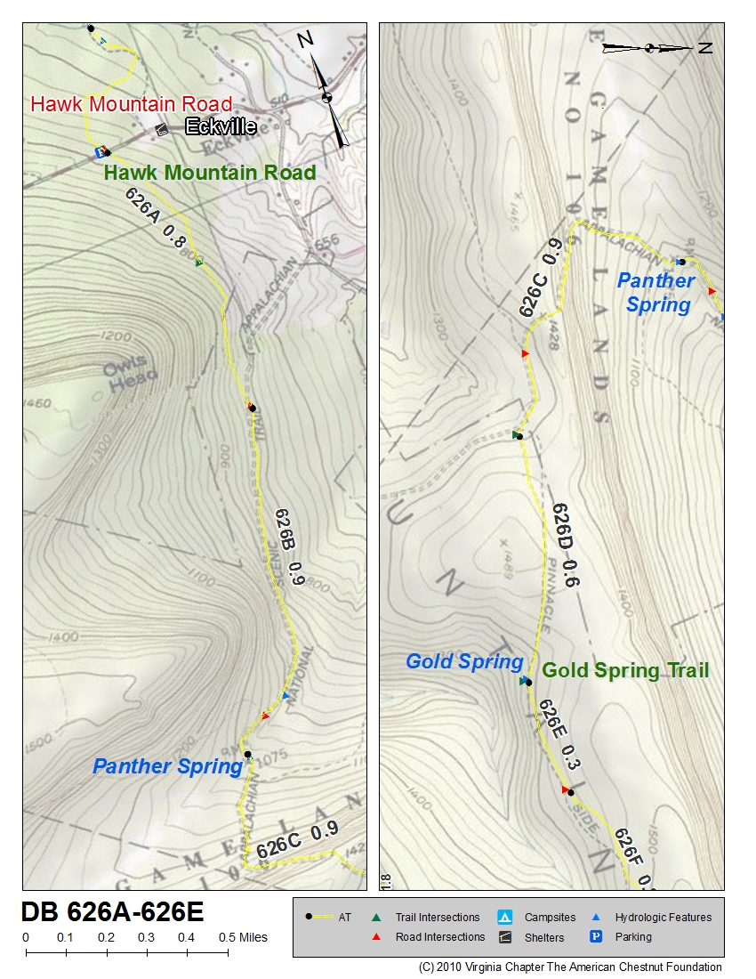
| PA | 626A | 626E | Hawk Mountain Road, Eckville Shelter | Map of 626A-626E | Chart of 626A-626E |
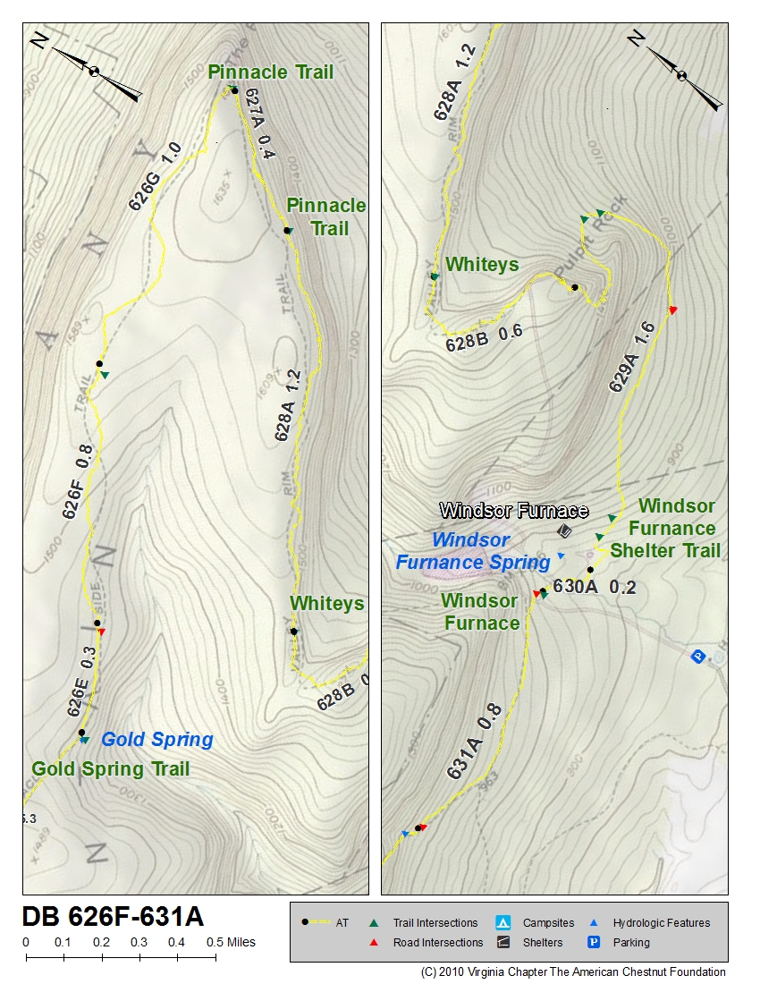
| PA | 626F | 631A | just north of Gold Spring Trail | Map of 626F-631A | Chart of 626F-631A |
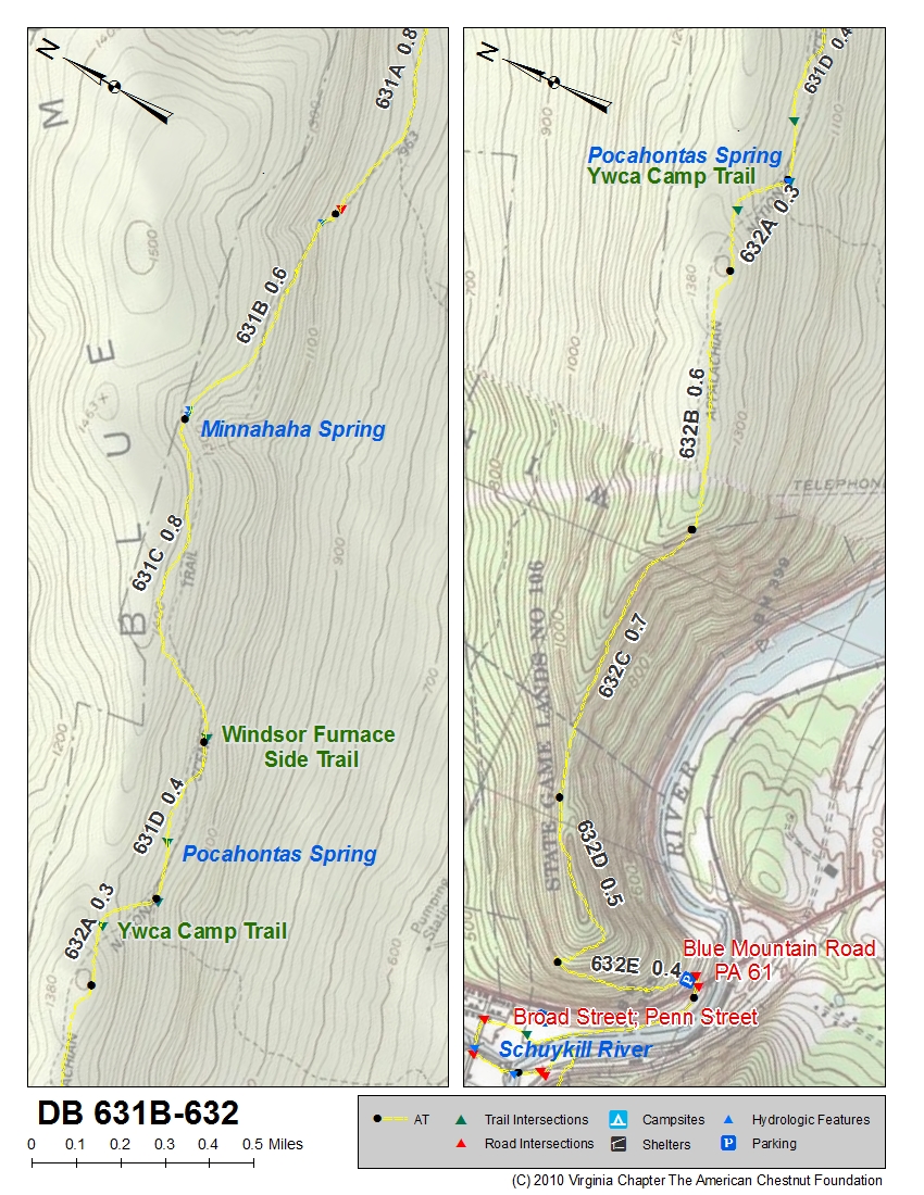
| PA | 631B | 632 | just north of Minnahaha Spring | Map of 631B-632 | Chart of 631B-632 |
| PA | 633 | 635A | PA 61 | Mao of 633-635A | Chart of 633-635A |
| PA | 635B | 637 | ~0.5 miles south of Phillip's Canyon Spring Trail | Map of 635B-637 | Chart of 635B-637 |
| State | Segment Begins | Segment Ends | Beginning Location of Segment | Map | Chart |
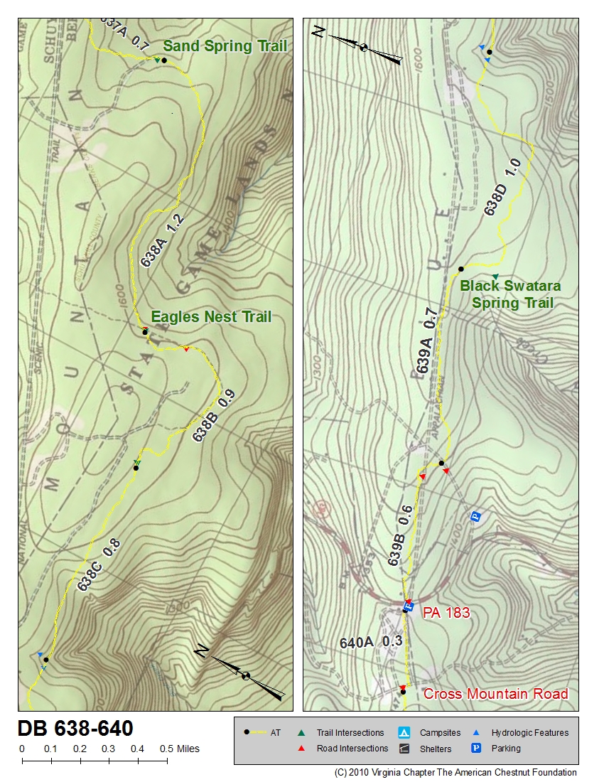
| PA | 638 | 640 | Sand Spring Trail | Map of 638-640 | Chart of 638-640 |
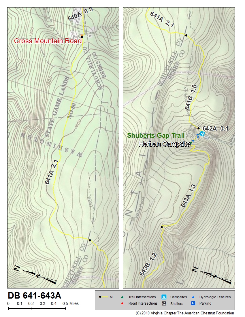
| PA | 641 | 643A | Fort Dietrich Snyder Marker | Map of 641-643A | Chart of 641-643A |
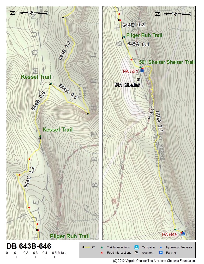
| PA | 643B | 646 | 1.3 miles south of Hertlein Campsite | Map of 643B-646 | Chart of 643B-646 |
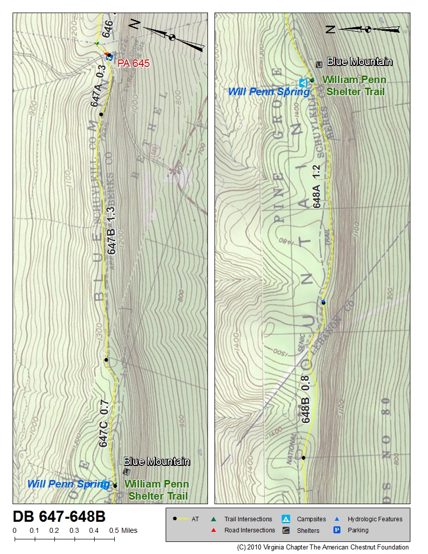
| PA | 647 | 648B | PA 645 | Map of 647-648B | Chart of 647-648B |
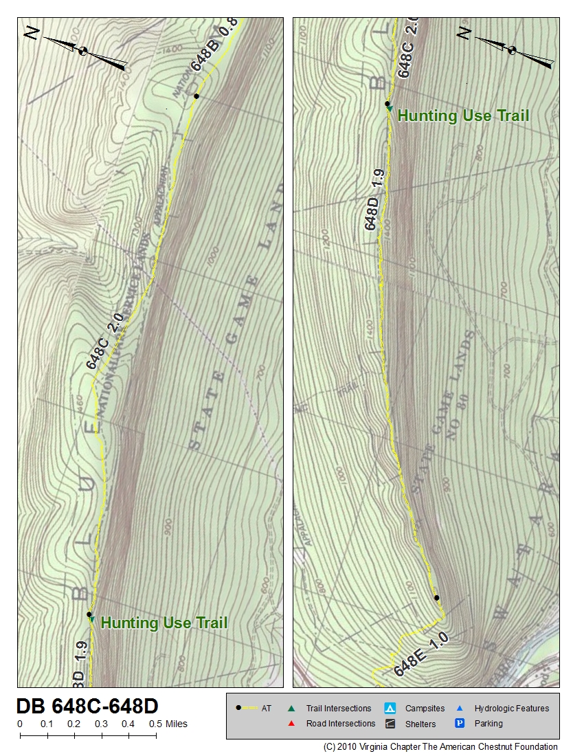
| PA | 648C | 648D | ~2 miles south of William Penn Shelter Trail | Map of 648C-648D | Chart of 648C-648D |
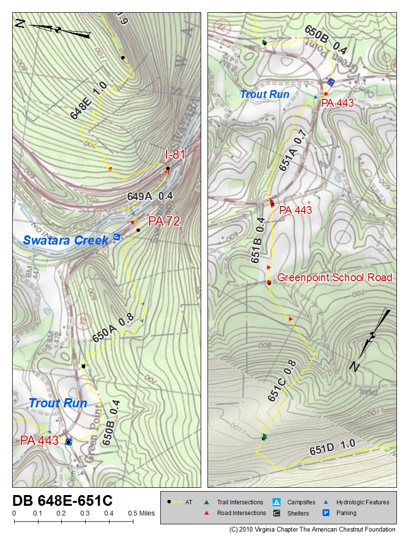
| PA | 648E | 651C | ~1 mile north of Interstate 81 crossing | Map of 648E-651C | Chart of 648E-651C |
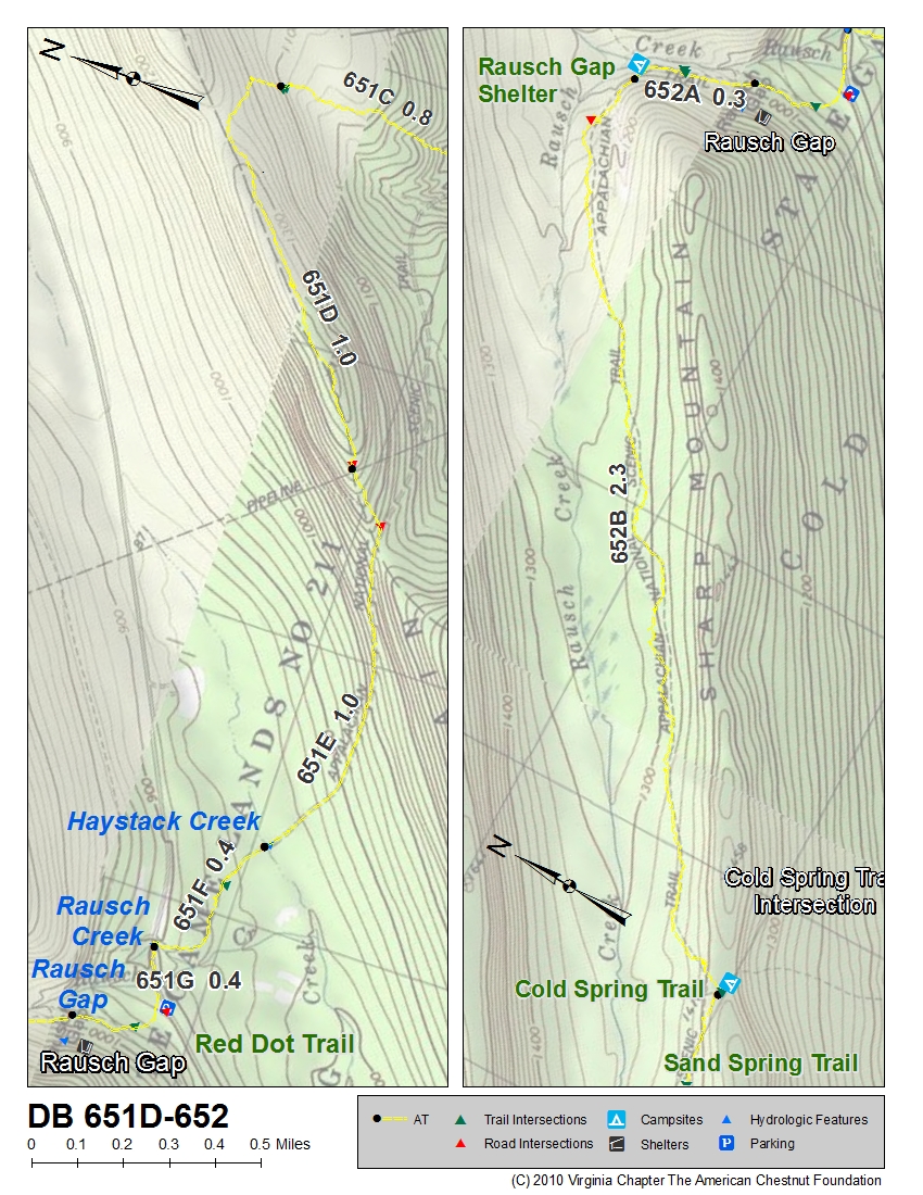
| PA | 651D | 652 | ~2 miles north of Haystack Creek | Map of 651D-652 | Chart of 651D-652 |
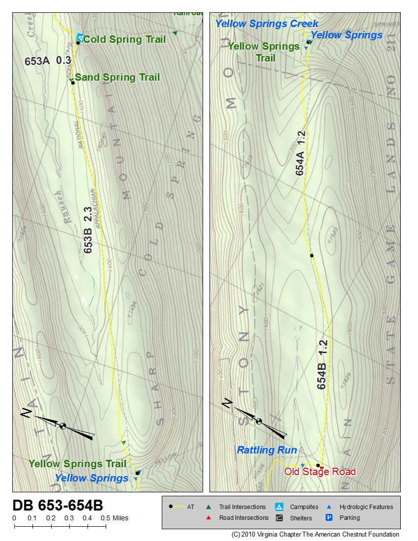
| PA | 653 | 654B | Cold Spring Trail | Map of 653-654B | Chart of 653-654B |
| PA | 654C | 657A | near Rattling Run and Old Stage Road | Map of 654C-657A | Chart of 654C-657A |
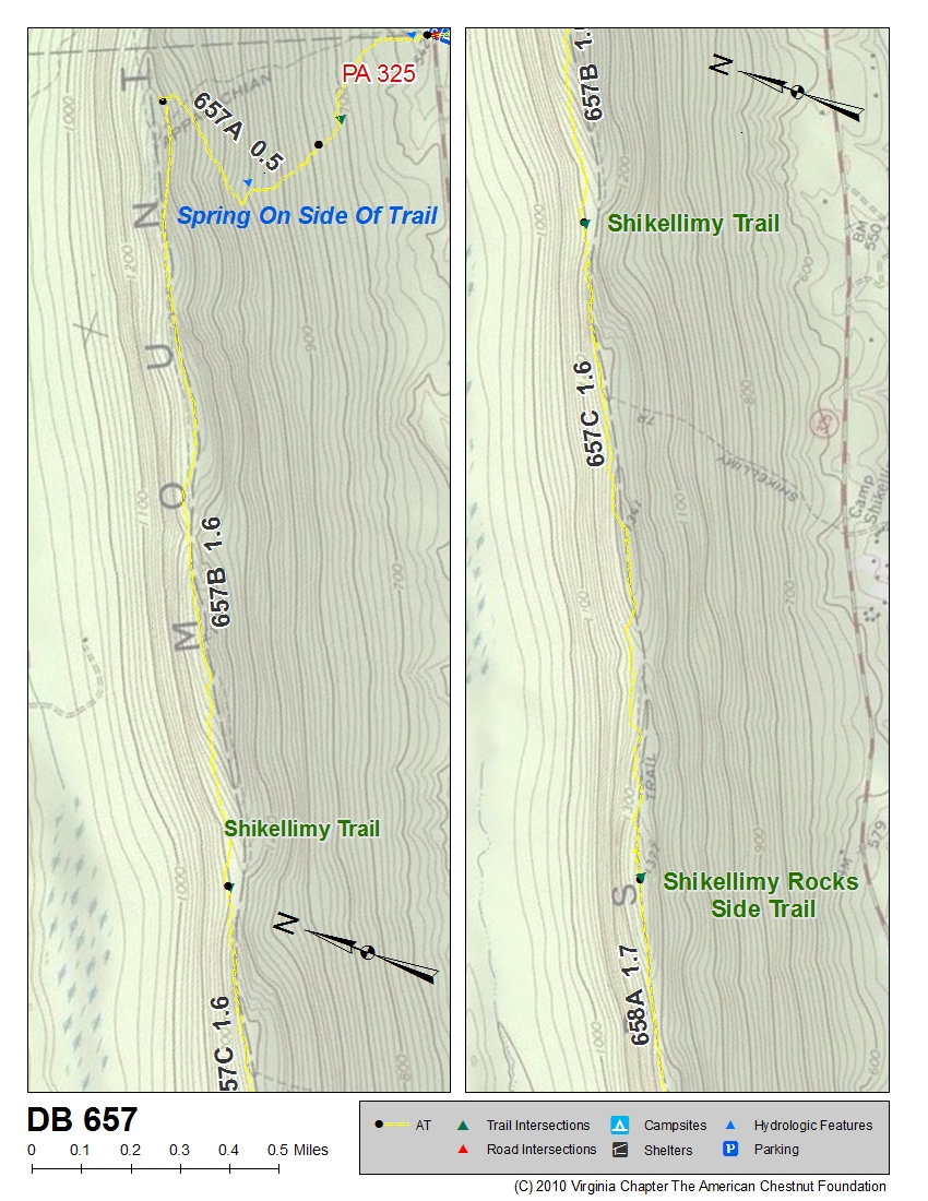
| PA | 657 | 657 | Spring | Map of 657 | Chart of 657 |
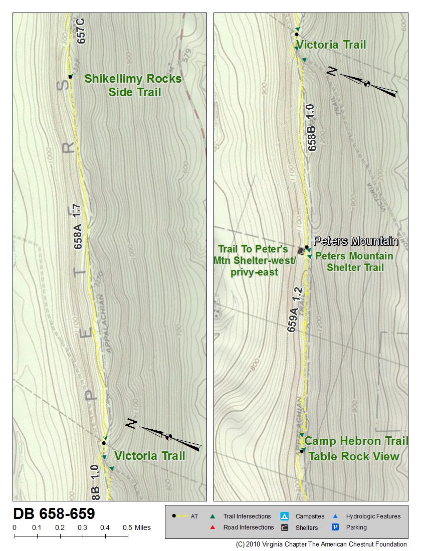
| PA | 658 | 659 | Shikellimy Overlook | Map of 658-659 | Chart of 658-659 |
| State | Segment Begins | Segment Ends | Beginning Location of Segment | Map | Chart |
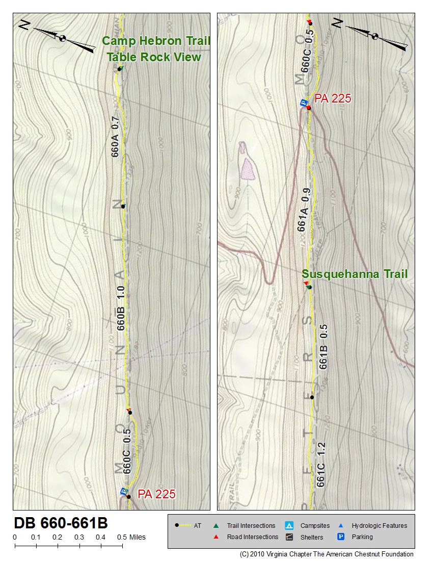
| PA | 660 | 661B | Table Rock | Map of 660-661B | Chart of 660-661B |
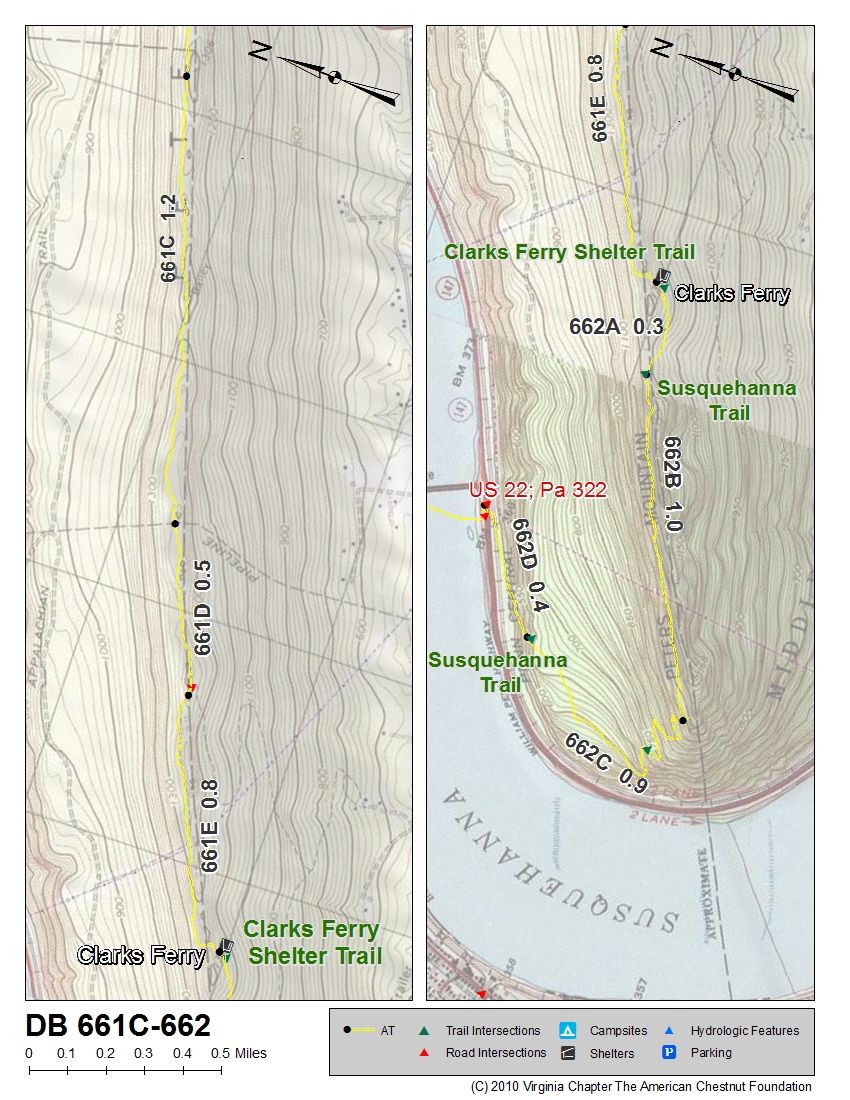
| PA | 661C | 662 | ~2 miles south of Susquehanna Trail | Map of 661C-662 | Chart of 661C-662 |
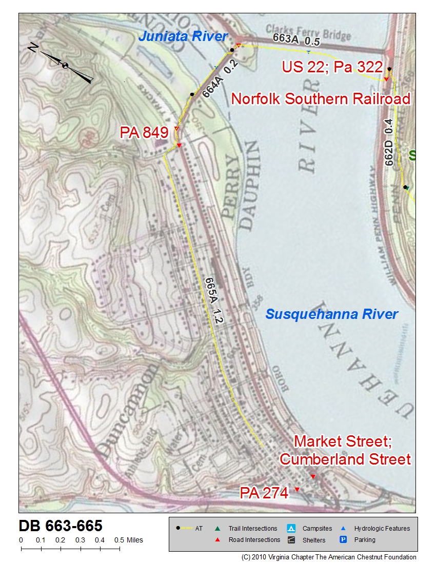
| PA | 663 | 665 | US 22 & 322, Norfolk Southern Railway | Map of 663-665 | Chart of 663-665 |
| PA (594) | 714 | 721 | Antietam Shelter, Old Forge Park | Map of 714-721 | Chart of 714-721 |
