Projected Coordinate Systems are defined on a flat, two-dimensional surface with different
projections causing different types of distortions. Various projected coordinate systems have
been developed for different regions that provides a common framework to perform spatial
analysis. Choosing the projection for data analysis requires knowledge of the spatial
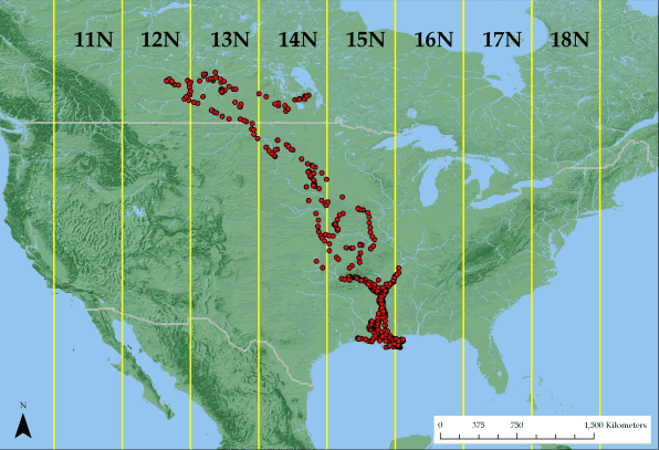
distribution and extent of GPS points (see for example Fig. 1.1; Walter et al. 2011).

Figure 1.1: American White Pelican with locations spanning 5 UTM zones
Use of the geographic coordinate system (i.e. latitude, longitude) is recommended in
cases of long distance movements and is often the default geographic collection method for GPS collar data. However, some home range software (e.g. BBMM package in R) requires
input coordinate data to be in meters so Albers Equal Area Conic or Universal Transverse
Mercator could be used (Fig. 1.2).

Figure 1.2: Turkey vulture locations only occurring in one UTM zone

